Solutions
Partners
Blogs
Contact
Automation
01
efficient designs, seamless integration
Calibration & Instrumentation
02
Precision through Calibration and Instrumentation
gas detection & safety
03
marine safety services, oil & gas supplier
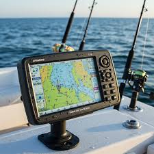
navigation
04
system integration and reliable solutions
communication
05
Uninterrupted connection, Seamless guidance
Global Support
06
Worldwide reach, trusted assistance